By Vincent Stanton, Jr.
Last May, the consultants hired by Belmont to design Phase 2 of the Belmont Community Path (extending from the Clark Street Bridge to the Waltham border) recommended a final route to the Community Path Project Committee (CPPC), which endorsed the recommendation and sent it on to the Select Board (see “Belmont Community Path Route Takes Shape,”September/October 2023 Newsletter, for details). The Select Board asked for more details on the right of way, which is the focus of current work.
The Pare Corporation-Toole Design team proposed two audacious Phase 2 design choices: a new bridge over the Fitchburg Line and a potential “box-over” of Waverley Station, which would create space for a pocket park. Here are the key questions:
- Are there precedents for such structures as elements of a pedestrian/bike path?
- How flexible has the MBTA been about similar structures traversing its property?
- Has the Boston Metropolitan Planning Organization (MPO) funded similar projects via the Transportation Improvement Program (TIP), the federal and state funding source Belmont will tap for construction?
Four recent TIP-funded projects bear on those questions, in Concord, Brookline, Milton, and Natick. Though none exactly matches the Belmont project, they provide insight regarding what is technically feasible, what the MBTA has allowed elsewhere, and what the Boston MPO will fund. Two earlier-stage projects in Cambridge shed further light on what neighboring communities will be proposing to the MPO.
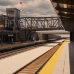
First, here are a few details about the bridge and box-over. A new bridge just west of Clark Street would allow the path to jump from the north side of the Fitchburg tracks to the Belmont Village parking lot on the south side. From there it would continue west, parallel to the tracks, all the way to Waverley Square, rising to meet the Trapelo Road bridge.
Locating the path on the south side would facilitate path connections to residential areas, to Town Field, and to the Senior Center, all on the south side of the tracks. For example, several hundred seventh- through 12th-graders in the neighborhoods surrounding Town Field would be able to reach the path by crossing at most one or two busy streets (Waverley, Beech). The path would provide a nearly straight route to the school, with no road crossings, potentially increasing the number of children walking or biking to school.
The proposed box-over of the depressed Waverley Station would provide an attractive green space to help anchor further development in Waverley Square.
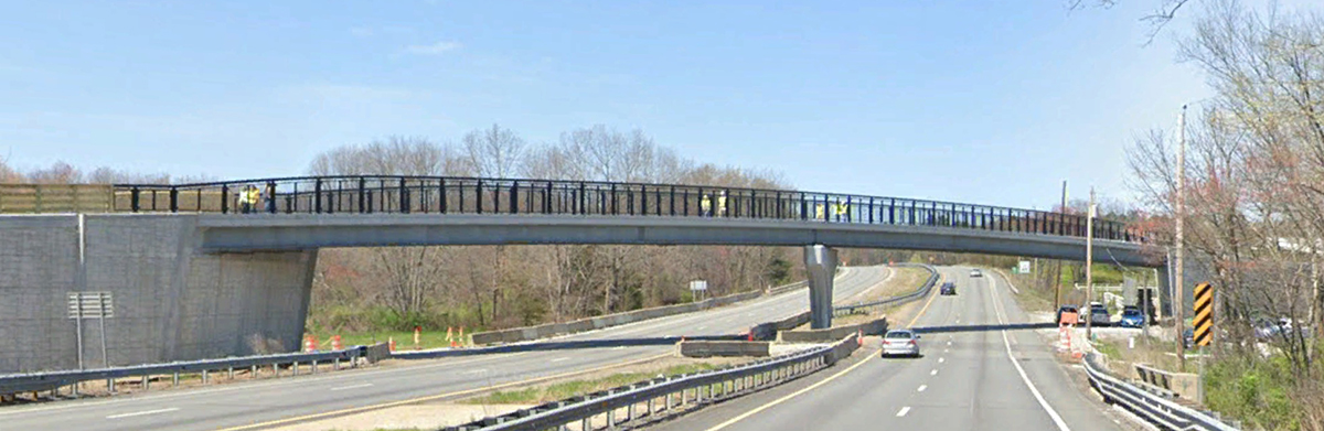
The Bruce Freeman Rail Trail bridge over Route 2 in Concord. Source: Google Maps
TIP-funded pedestrian-bicycle bridge: Bruce Freeman Rail over Route 2 in Concord
The Bruce Freeman Rail Trail, when complete, will connect Framingham to Lowell via a 25-mile abandoned railway corridor traversing six intervening towns. In 2013, the Boston MPO voted to allocate $23 million to construct 7.5 miles of trail, including $6.3 million for a bridge over Route 2 in Concord, dedicated for trail use.
Originally scheduled for construction in 2017, the bridge was started in May 2020 and completed last summer as part of a 1.04 mile trail segment. The project also included a replacement bridge over Nashoba Brook and a wildlife culvert under Route 2, at a final construction cost of $9,957,790. The bridge is an imposing 304-foot-long structure that rises and descends gently to conform with federal Americans with Disabilities Act (ADA) requirements and corresponding state regulations.
The proposed Belmont bridge over the tracks west of the Clark Street Bridge would be shorter and would almost certainly be less costly. At a public forum on May 17, 2023, the Pare team suggested bringing a prefabricated, one-piece truss bridge to the site and installing it on newly constructed abutments. Subsoil studies confirmed that the earth would support the abutments. In contrast, the Route 2 bridge is a conventional concrete and steel structure that was built in place over two years.
Carlton Street footbridge, Brookline. Source: Brookline News
TIP-funded pedestrian-bicycle bridge: Carlton Street footbridge in Brookline
The TIP-funded reconstruction of a historic pedestrian bridge in Brookline illustrates the potential flexibility of the MBTA regarding bridge clearances and the potential uses of TIP funds for aesthetic ends.
Constructed in 1894 as an element of Frederick Law Olmsted’s Emerald Necklace, the Carlton Street footbridge crosses over the Green Line D branch, connecting a residential neighborhood to Riverway Park along the Muddy River. In 2019, after two decades of advocacy, the project was awarded a $3,955,053 TIP grant for reconstruction.
The rusty old bridge was disassembled and shipped in pieces to a company in Rhode Island where it was sandblasted, painted, and structurally reinforced, then transported back to Brookline and reassembled. The project, completed in July 2023, also includes new ADA-compliant ramps and extensive landscaping.
According to Brookline construction project coordinator William Smith, the 1894 bridge cleared the tracks by 14 feet, 3 inches. The refurbished bridge clears the tracks by 15 feet, 6 inches, which required an MBTA waiver. Green Line trains are powered by overhead electric cables which pass (just) beneath the bridge. That is different from the diesel-powered MBTA commuter rail system, including the Fitchburg Line, which also occasionally carries freight. Nonetheless, the MBTA’s flexibility allowed the old bridge to be restored very close to its original dimensions.
Brookline is currently designing a second pedestrian/bicycle bridge over the Green Line at Davis Street, where an old bridge that used to cross over the Boston & Albany Railroad tracks (now part of the Green Line D branch) was removed decades ago and not replaced. The new design, approved by the MBTA, clears the tracks by 18 feet.
Both the Lexington Street and Trapelo Road bridges in Belmont, as well as at least half a dozen other Fitchburg Line bridges, clear the tracks by only 18 feet, which was the old standard.
The implications for Belmont: as noted at the May 17 public forum, a new bridge may not have to clear the Fitchburg tracks by 22.5 feet, the current MBTA design standard. Lowering the bridge would reduce the visual impact, lower construction costs, and improve the user experience by reducing the climb in both directions.
Why not route the path across the Clark Street Bridge?
You, reader, might reasonably ask: why not use the existing Clark Street Bridge to cross the Fitchburg tracks? There are several problems with that route. The most important is the lack of a satisfactory route back to the south side of the Fitchburg Line tracks (the only place where there is space for an off-road path). Clark Lane is a type of private way where the property lines extend to the middle of the street, formerly the location of Clark’s Brook, so the residents own the street. During the 2016–2017 feasibility study, residents made it clear they would not give up their property for a path.
Absent a direct connection from the southern terminus of the Clark Street Bridge to the back of the Belmont Village Parking lot via Clark Lane, path users would have to be routed along Clark Street, Thomas Street, Waverley Street, and Midland Street to reach the back of the Town Yard. Three of those streets are relatively busy and narrow; there is no space for on-street parking. The path would be highly constrained, and bicycle users would mix with cars.
A second problem is that the existing bridge is only six feet wide, which does not meet the minimum eight feet required by MassDOT for path fundability. Widening the bridge would result in loss of its grandfathered status as an 18-foot clearance bridge that preceded the MBTA’s change to a 22.5-foot clearance standard. It is possible that a waiver could be obtained, but not certain. If not, raising the bridge 4.5 feet above its current height would require substantial grading on the south side, possibly including a switchback ramp, to meet ADA requirements. The cost of those changes has been estimated to approach the cost of a new bridge.
To be clear, the design recommended by the Pare-Toole team leaves the Clark Street Bridge intact; it will still be an access point to and from the path, just not an element of the path.
East Milton Square box over Route 93 in 2022 prior to renovation. Source: Patch.com
TIP-funded box-over: East Milton Square
In 1959, the Southeast Expressway (Route 93) was completed, creating a noisy canyon through East Milton Square: 121 houses were demolished or moved, 12 businesses closed, a 7-acre playground eliminated, and the town’s main commercial center transected. To reconnect the business district and to restore a sense of place in East Milton Square, the town obtained state and federal funding in the 1970s to construct a platform over Route 93, with a small park (later named Manning Park) sited over the highway.
Starting in 2010, Milton has engaged in a contentious redesign process for the East Milton Square box-over. Car users have advocated for more parking and relief from traffic congestion, while walking/biking and open space advocates have opposed those changes. In 2017, an initial design that replaced a small amount of designated parkland with parking spots was rejected by the Massachusetts Department of Transportation (MassDOT) and the Federal Highway Administration. A subsequent redesign of the box-over passed muster with the Boston MPO and was awarded $6,849,943 in TIP construction funding in 2019.
The project encompassed deck reconstruction (the platform over the highway), road and sidewalk improvements, and the complete reconfiguration of Manning Park, including 67 new trees, 800 shrubs, and 368 perennials. None of the latter elements serve a transportation purpose, yet were deemed eligible for TIP funding as part of the larger project.
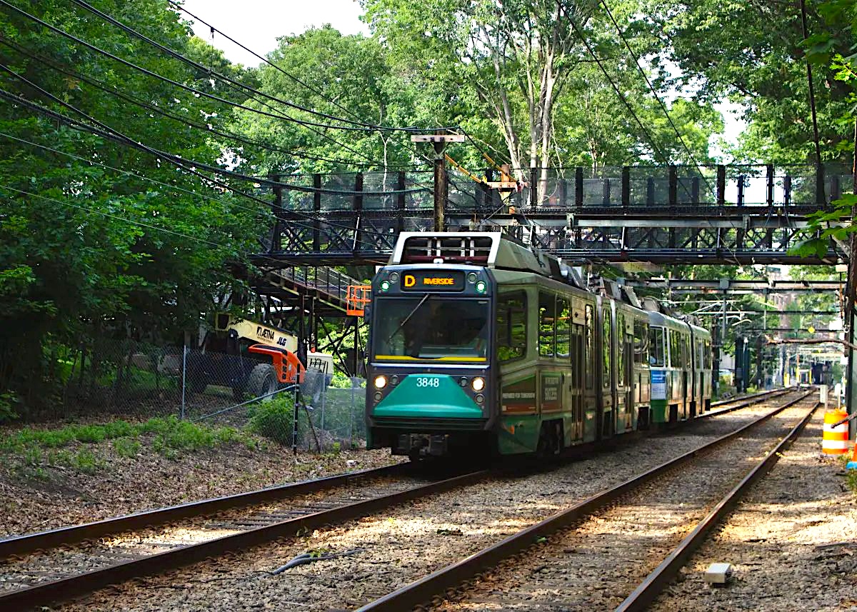
The sundering of East Milton Square by Route 93 could be compared to the cleaving of Waverley Square in 1952 by the Boston & Maine Railroad, which buried the Fitchburg Line tracks in a 20-foot-deep trench. That project, motivated by safety concerns, altered the configuration of Waverley Square that had existed since 1844, when the Fitchburg tracks were laid through the square at grade, supplemented by the Central Massachusetts railroad tracks in 1882.
However, while improving safety, the 1952 track-lowering project—accompanied by construction of the Trapelo Road and Lexington Street bridges—removed the heart of Waverley Square. Indeed, a 2022 study of Waverley Square by the Urban Land Institute (a group of real estate professionals including planners, developers, property managers, and land-use lawyers who volunteer to investigate the development potential of specific neighborhoods) concluded that the square had “not enough sense of place” to anchor a robust business district. That echoed the conclusions of the Pare team in 2017 when they proposed the box-over in the Belmont Community Path feasibility study.
In both East Milton Square and Waverley Square, state transportation infrastructure transects a vital commercial center. The fact that remediation of that harm in Milton was deemed eligible for TIP funding (along with road and sidewalk improvements and a park) is a potential precedent for the Belmont project.
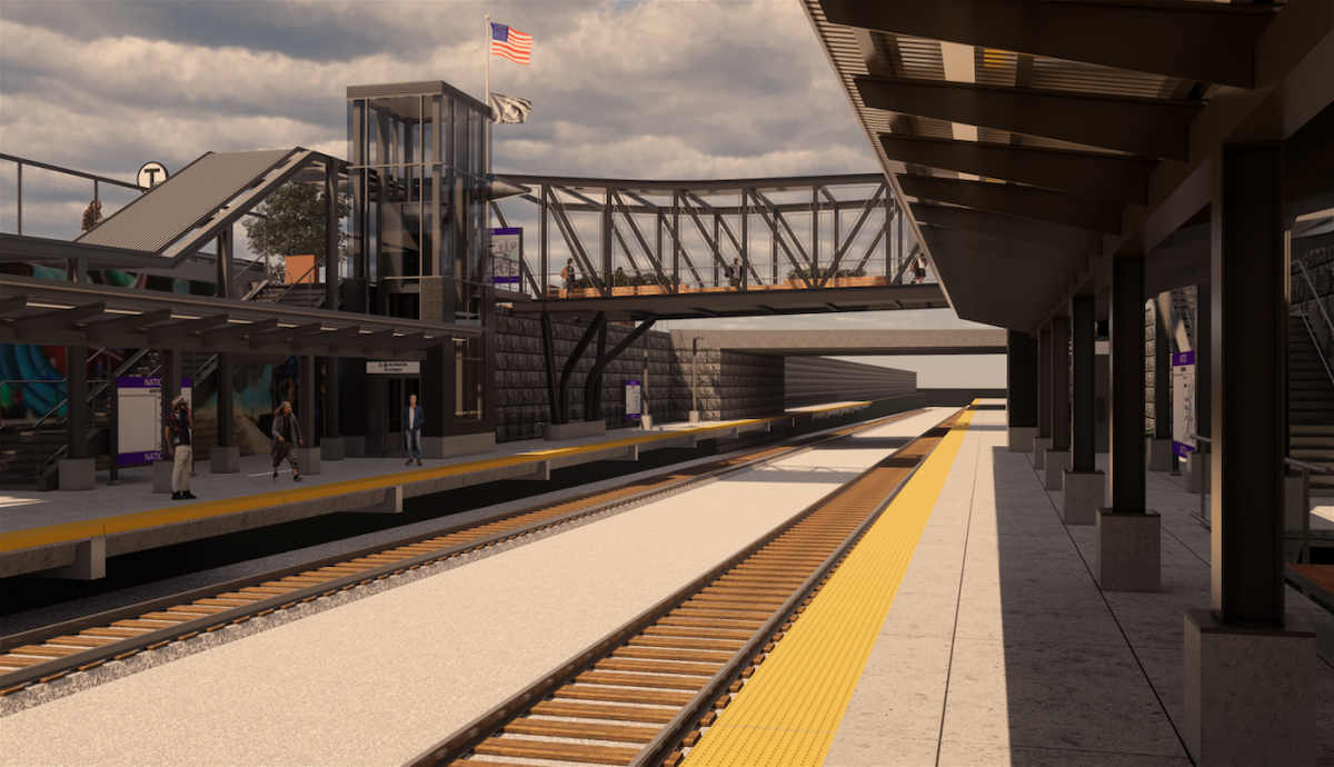
Rendering of the Natick commuter rail station with pedestrian bridge. Source: MBTA.com
TIP-funded partial box-over: Natick Center commuter rail train station
As in Waverley Square, the tracks of the MBTA’s Framingham-Worcester Line run through Natick Center in a deep trench. In 2012, the town funded a feasibility study that explored how to bring the station into ADA compliance, including high boarding platforms (level with the floor of the train so handicapped individuals don’t have to climb or descend stairs), while also improving access for all modes of travel, including a connection to the Cochituate Rail Trail.
The feasibility study contemplated a partial box-over of the station, extending a small park adjacent to the station (Moran Park) over the tracks. In the final MassDOT-approved design, funded by the Boston MPO, the box-over park was replaced by a wide, covered, four-season pedestrian bridge that provides a resting area for passengers or others crossing the tracks. The bridge/waiting area, while less ambitious than the full station box-over initially contemplated, is nonetheless an amenity—considerably more than the minimum required. The Natick Center project was allocated $10,739,265 in TIP funds and is scheduled for construction in 2024.
The project provides a precedent for “nice to have” infrastructure at an MBTA commuter rail station.
The future of Waverley Station
In 2012, the MBTA made modest repairs to the boarding platforms at Waverley Station, consisting mostly of asphalt patching and painting. Unfortunately, those small improvements triggered the expiration of a waiver, granted by the Massachusetts Architectural Access Board (MAAB), which exempted the station from having to be in compliance with the accessibility requirements of the federal ADA and corresponding state law. (All older, non-ADA compliant MBTA stations operate under a similar waiver. They can’t be improved without addressing ADA compliance.)
In 2016, the MAAB, in a public meeting, pushed senior leadership of the MBTA Fiscal and Management Control Board to make Waverley Station accessible, using it as a prod to get the agency to devote more resources to ADA improvements. The MBTA argued (correctly) that accessibility upgrades at other stations would benefit more customers, and promised to accelerate those upgrades. With that commitment from the MBTA, in June 2016, the MAAB granted Waverley Station a 10-year extension of its waiver to be in compliance with ADA standards. That waiver is now only two and half years from expiration, yet there is no plan to improve the station. Indeed, MBTA officials have communicated to the Pare team that the station is a low priority.
The Belmont Community Path potentially offers an opportunity to make ADA-compliant connections to the station using TIP dollars. A low-cost option would be spurs from the path on both sides of the station to the boarding platform (the main route will cross Trapelo Road and Lexington Street at grade). A high-cost option would be a full ADA upgrade, as will be implemented in Natick Center, with high boarding platforms and elevators. Both options are among those tabled by Belmont’s design team, as well as the option of leaving the station untouched by the path. Unfortunately, the opportunity to use TIP money to make ADA improvements at Waverley Station has no chance of moving ahead without a supportive and engaged MBTA.
Absent a plan for improvements, there is a real threat that the MAAB will compel the MBTA to close the station in June 2026.
Proposed pedestrian-bicycle bridge projects in Cambridge
The four projects described above have either been constructed or scheduled for construction. Two other bridge projects in Cambridge, both straddling the Fitchburg Line, are short of the 25% design stage at which TIP funding is typically sought. The two bridges would cross the tracks on either side of the Alewife Parkway bridge, one about 800 feet to the west, connecting the “quadrangle” to the “triangle” (see “Building Booms on Belmont’s Border,” January/February 2020 Newsletter), the other about 1,350 feet to the east, connecting the Jefferson Park affordable housing development to Danehy Park and Fresh Pond Mall (see Cambridge Community Development for details). A feasibility study of the latter project was just completed in September, while the former project, which has been under discussion for decades, appears semi-dormant at present, though Cambridge has the necessary land parcels and easements, and has been collecting fees from developers for years to pay for it.
To put these two proposed bridges in context, the existing Sherman Street bridge crosses the Fitchburg tracks about 1,100 feet east of the proposed Danehy Park crossing, and the existing (recently renovated) Yerxa Road pedestrian/bicycle underpass is about 950 feet east of Sherman Street. Thus, if both new bridges were built, there would be a bridge or tunnel across the Fitchburg Line roughly every 1,000 feet—five over a 4,100-foot span.
In fact, until March 2021, yet a third pedestrian/bicycle bridge over the Fitchburg tracks was on the table, extending from the end of Smith Street (about 1,700 feet west of the proposed quadrangle-triangle bridge) north to the Fitchburg Cutoff path (covered in Cambridge Day). That bridge would have been paid for by a developer in exchange for higher zoning density, but when the city and developer couldn’t agree on all aspects of the rezoning plan, the proposal was withdrawn.
While population density in the Cambridge neighborhoods that would be served by the two new bridges is certainly greater than anywhere in Belmont, still, five bridge or tunnel rail crossings in 4,100 feet is a lot. Both new Cambridge bridges would be tied to large housing projects with a significant affordable component, as would be the case in Belmont. In any event, the Belmont bridge proposed by the Pare-Toole team hardly looks ambitious in the context of the multi-bridge Cambridge plans about two miles away.
In conclusion, there is ample precedent for both of the innovative design elements proposed by the Pare-Toole team with respect to constructibility, MBTA cooperation, and TIP funding. Indeed, the lesson from our neighboring communities regarding path projects seems to be: think big!
Waverley and the community path
The fact that Natick Center is the second busiest non-accessible station on the MBTA’s Framingham-Worcester Line certainly improved its TIP score compared to a less utilized station like Waverley. Waverley Station is the fourth least busy of the 19 stations on the Fitchburg Line (average weekday boardings inbound: 82 on, 32 off; outbound: 33 on, 119 off, in 2018, the most recent data available), not far behind Belmont Center. The light use is partially attributable to the available service. Eleven of the 17 weekday inbound trains and 12 of the 17 outbound trains are flag service only (i.e., passengers have to “flag down” the train, or, if already on board, tell the conductor that they wish to get off at Waverley in advance).
More important may be the comparatively small business district. The path may help with the latter by shortening the trip from Waverley Square to the large Duffy Brothers development along Waverley Oaks Road in Waltham, the site of 1,200,000 square feet of office, retail, restaurant, and recreational space. The Belmont path (via the Waltham path) will provide a direct route from Waverley Station to the office park.
Vincent Stanton, Jr. is a director of the Belmont Citizens Forum.

Sorry, the comment form is closed at this time.