By John Dieckmann. Photos by John Dieckmann
In January, biking might not be on too many people’s minds, but with spring only a couple of months away, this seems like a good time to take stock of the regional rail trail network.
The Belmont Community Path is a short but essential link in the long distance Mass Central Rail Trail (MCRT), which connects to several other rail trails in its 104 miles from Northpoint Park in Cambridge, near the Science Museum, westward all the way to Northampton. This update covers the roughly 30 miles of the MCRT and connecting trails inside I-495.
Near I-495, in Hudson, the MCRT connects with the Assabet River Rail Trail, and runs eastward 16 miles to the Weston-Waltham town line. Passing through Sudbury, the MCRT crosses the Bruce Freeman Rail Trail (BFRT). The partially complete Bruce Freeman Rail Trail will eventually span the distance from from Sudbury to Lowell and also extend south to Route 9 in Framingham.
At Alewife Station, the MCRT connects to several trails: the Minuteman Bikeway, the Alewife Greenway, and the Watertown-Cambridge Greenway. The last of these will connect to the Paul Dudley White Path along the Charles River when construction is completed in 2021.
Closer to Boston, near a future Somerville Green Line Extension Station, the MCRT will eventually connect to the Northern Strand Community Trail. Also known as the Bike to the Sea trail along the former Saugus Branch Railroad, this section runs through Everett, Malden, Revere, Saugus, and Lynn, ending at the Lynnway, near Nahant Neck.
Here are the details on all these trails, starting with the MCRT.
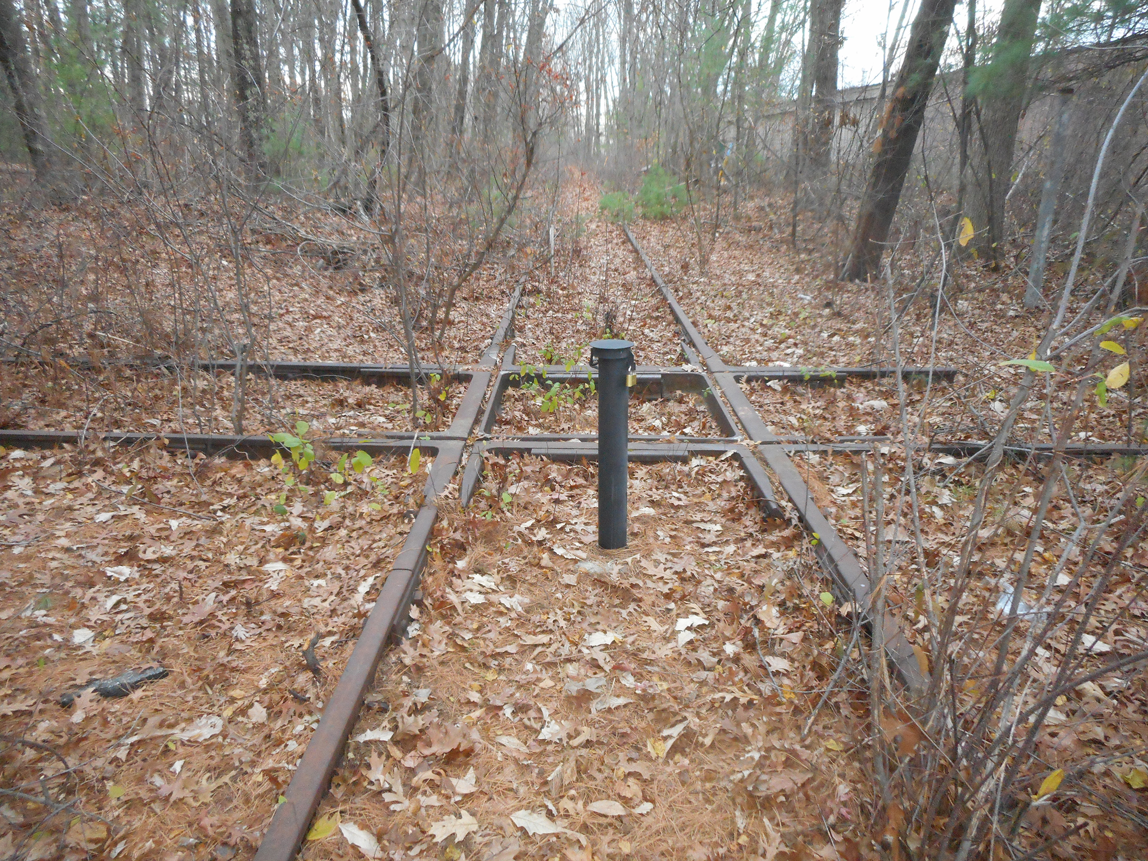
Crossing of the as-yet-unpaved rights of way for the Mass Central Rail Trail and the Bruce Freeman Rail Trail in Sudbury, 200 yards north of Route 20 and 100 yards west of Union Avenue.
Mass Central Rail Trail segments
The westernmost section of the MCRT is the level Norwottuck Trail, which runs between Northampton and Amherst, in Hampshire County. It has been open since 1992 and was repaved recently. Wachusett Greenways has developed close to 20 miles of the MCRT in Worcester County, and the East Quabbin Land Trust has developed a few more miles in Hardwick.
Advocacy for the Belmont Community Path segment dates back to the mid-90’s. (See “Community Path Proponents Offer FAQ,” Belmont Citizens Forum Newsletter, November/December 2020.) An engineering feasibility study completed in November 2017 identified route alternatives and recommended a preferred route, which was broken into Phases 1 and 2. Phase 2 covers the western portion, from Belmont Center (Clark Street to be precise) to the Waltham town line, a few hundred yards west of Lexington Street. Phase 1 covers the eastern portion, from Clark Street to the existing Fitchburg cut-off path at Brighton Street, and includes a pedestrian tunnel under the commuter rail tracks behind the high school. The detailed design of Phase 1 is fully funded and the project was awarded to Nitsch Engineering. Last July, Nitsch reached the milestone of completing the draft 25% design. Comments have been received and design adjustments have been made.
The next step is to formally submit the 25% design to MassDOT (Department of Transportation) for approval. When MassDOT approves the design, the project will be eligible to be submitted to the Boston Region Metropolitan Planning Organization for federal and state funding for construction. After that the detailed design needs to be completed. Finishing construction and opening the trail don’t have a firm timeline, but four or five years from now is probably realistic. Starting the Phase 2 detailed design will likely wait until the Phase 1 detailed design has been completed.
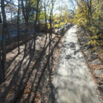
East of Belmont, the MCRT follows the completed Fitchburg cut-off path to Alewife Station, then the Linear Park path to Davis Square in Somerville and the Somerville Community Path, which is now complete to Lowell Street. The final leg of the Somerville Community Path to Northpoint Park, Cambridge, is being constructed as part of the Green Line Extension. It is expected to be complete next autumn.
Weston-Waltham
West of Belmont, the next four miles of the MCRT pass through Waltham. The detailed design of the three-mile portion between Beaver Street and Main Street is nearly complete and ready to go out to bid for construction, which Waltham will pay for with Community Preservation Act funds. Construction could start in summer 2021 and be completed in 2022.
Two Waltham portions remain unconstructed: a half-mile stretch from Main Street to the Weston town line, and a three-quarter-mile stretch between Beaver Street and the Belmont town line. Higher priority might go to the connection with Weston, because it is easier and construction of the MCRT is complete in Weston.
The next stretch of rail trail in the towns to the west shares a right of way (ROW) with an Eversource electric power transmission line. Fortunately, Eversource has been willing to construct the trail as a means to provide vehicular access for maintenance of its transmission line. Eversource constructed the trail to the level of a gravel roadway, and the Department of Conservation and Recreation (DCR) found the funds to pay for paving. Five miles of the MCRT have been open for more than a year through all of Weston, and into Wayland as far as Russell’s Garden Center on Route 20. Eversource plans to continue the transmission line and the trail through the rest of Wayland, all of Sudbury, and into Hudson as soon as legal challenges to the transmission line are resolved, bringing the MCRT close to I-495.
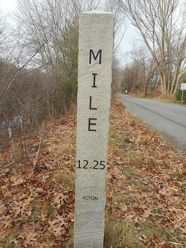
Sign post on the Bruce Freeman Rail Trail.
Bruce Freeman Rail Trail
Advocacy for the first-rate Bruce Freeman Rail Trail (BFRT) dates back to 1986. The trail boasts a high quality paved surface, well-designed road crossings, excellent signage, and amenities like port-a-potties, mile markers, and benches.
The BFRT follows the abandoned ROW of the Framingham-Lowell branch of the Boston and Maine Railroad. Phase 1, open since 2009, runs from the Cross Point parking lot in Lowell south for 6.8 miles to the Acton-Westford line at Route 225, a few yards East of Route 27. Phase 2, which is mostly open, continues through Acton-Concord-Sudbury. Phase 3, which has yet to be built, runs from Station Road in Sudbury, where it crosses the MCRT, for 1.4 miles to the Framingham line and another 5 miles in Framingham to Route 9.
Phase 2B, the Route 2 overpass, is currently under construction and is expected to open in the late spring or early summer, at which point BFRT Phases 1, 2A, 2B, and 2C will be complete, running continuously for 15 miles, from Cross Point in Lowell to the Concord-Sudbury town line.
Phase 2D and Phase 3 in Sudbury are in process. The 25% design for Phase 2D (Concord town line south to Station Road in Sudbury) was approved by Mass DOT this past August. A design contractor for completion of the detailed design is in the process of being selected, and the design should be complete by fall 2022 to stay on the current TIP schedule for construction funding. In a November 3, 2020, referendum, Sudbury voted overwhelmingly to approve purchasing the 1.4 miles of right of way corridor between Station Road and the Framingham line. The schedule for design and construction has not been established yet.
In Framingham, the 4.8 mile ROW is owned by CSX railroad, which wants to abandon and sell the corridor. Framingham recently adopted the Community Preservation Act, which should provide the funds needed to acquire the ROW. The overall timing is to be determined, but will be later than the completion of the BFRT in Sudbury.
Assabet River Rail Trail
The Assabet River Rail Trail (ARRT) has two completed, paved sections: six miles open since 2005 in Marlboro and Hudson, and four miles since 2018 in Maynard and Acton. Between these two sections are four miles in Stow, of which the 1.9 miles closest to Maynard is a gravel road, called Track Road, that runs along the Assabet River and is passable and open to cyclists and pedestrians. The other two miles of the right of way are in private hands, and it will be some time before this stretch becomes available. While this section can be bypassed on Sudbury Road and Route 62, neither is particularly bike-friendly.
Minuteman Commuter Bikeway (and Western Extensions)
Close to home is the familiar Minuteman Commuter Bikeway, the bike trail that runs from Alewife Station to Bedford Depot. It has been open since the early 1993 and one of the most heavily used rail trails in the United States. Less familiarly, extending from the Bedford Depot end are the Narrow Gauge Trail and the Reformatory Branch Trail. The Narrow Gauge Trail reaches Billerica, and may in the future provide a connection via the Concord River Greenway to the Bruce Freeman Rail Trail in Lowell. The Reformatory Branch runs toward Concord and may in the future provide a connection to the BFRT in West Concord.
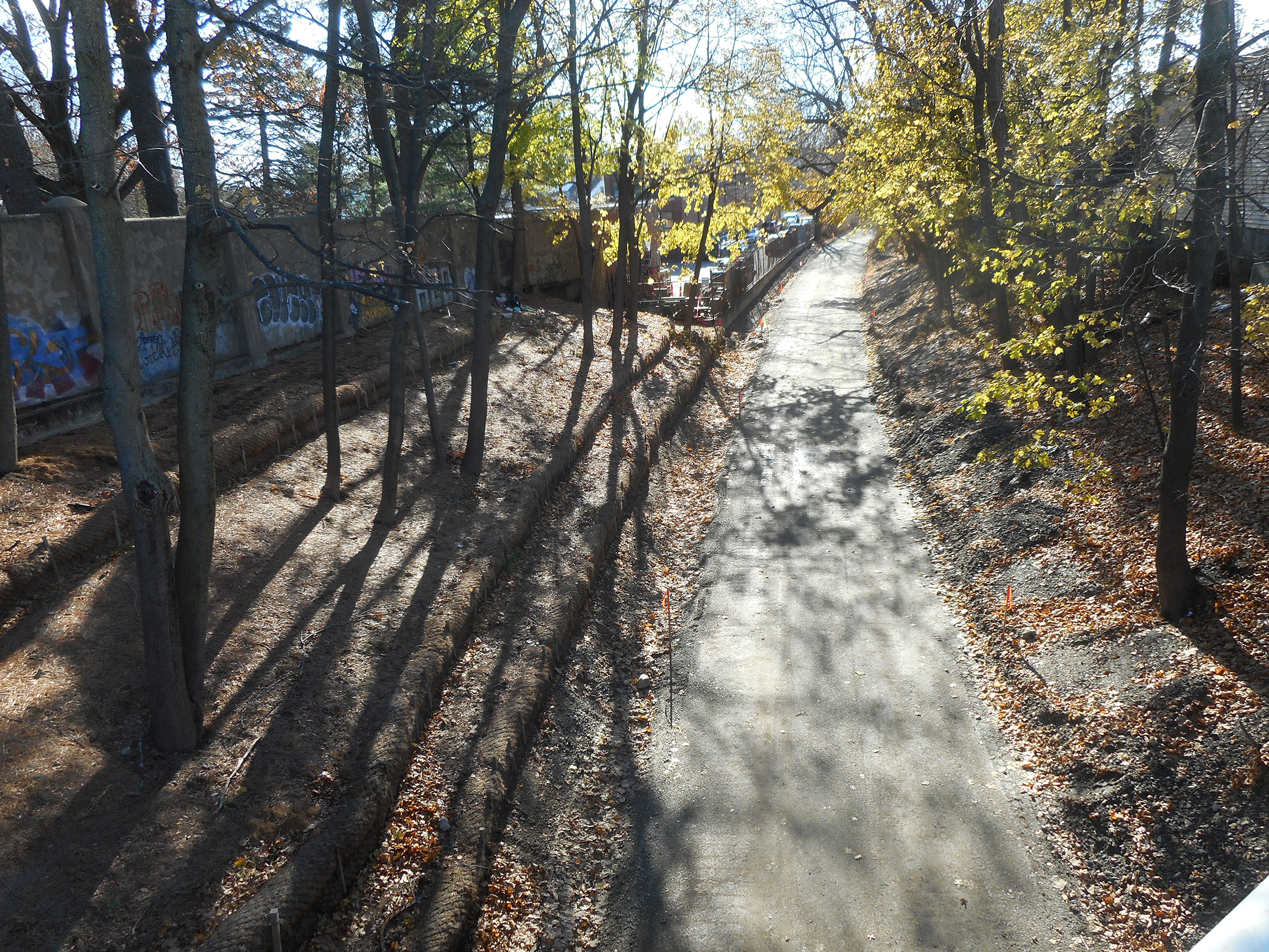
The Watertown-Cambridge Greenway, graded and prepared for paving, at the Mt. Auburn Street/Belmont Street intersection. Paving is scheduled to be finished in summer 2021.
Watertown-Cambridge Greenway
The Watertown-Cambridge Greenway will connect the Charles River Greenway to the trails radiating from Alewife Station. The section from Nichols Avenue to School Street has been open since 2011, and the segment along the Fresh Pond Parkway side of the Fresh Pond Reservation has also been open for some time. Continuing toward Watertown, from Huron Avenue in Cambridge to Nichols Avenue in Watertown, construction is underway and should be completed in summer 2021.
From Concord Avenue to the Fitchburg commuter rail line, the city of Cambridge owns the abandoned right of way immediately behind the Fresh Pond Mall. The city plans to extend the greenway over this corridor. Funding for the design is in hand, and the design process is underway. In the meantime, cyclists have been using the wide sidewalks along both sides of Fresh Pond Parkway to travel from Alewife to Fresh Pond.
Northern Strand Community Greenway
The Northern Strand Community Greenway has been a work in progress for close to three decades. Bike to the Sea has tirelessly advocated since 1993 for the trail to be developed over the right of way of the Saugus Branch railroad, which ended passenger service in 1958 and ceased operation altogether in 1993.
Currently the trail runs roughly northeast for 10 miles between Wellington Street in Everett (a few hundred yards north of Route 16) and the Lynnway. Paving was completed in Everett and Malden by late 2013, with construction (primarily final paving) in Lynn and Saugus still ongoing in several segments. All of this construction is on track to be completed by summer 2021.
In Everett and Malden, the trail is very urban, running though industrial, commercial, and dense residential areas. Moving east into Revere, Saugus, and Lynn, the territory is a combination of suburban and open parkland, much of it saltwater marshes. The Lynnway end is close to Nahant Neck and some nice beaches. Figure 6 is a photo taken close to the Everett trail head, looking south toward the Encore casino.
In the future, the trail will be extended from the Everett trail head south to the Mystic River just west of the Encore Casino along a clear right of way. Further into the future, a bike and pedestrian bridge is planed for the Mystic River, and the trail will extend to Assembly Row in Somerville for a close connection with the MCRT near the planned Gilman Square Green Line Station.
John Dieckmann is a director of the Belmont Citizens Forum.

Sorry, the comment form is closed at this time.