By Sara Smith, Eric Batcho, and Jarrod Goentzel
What is the Belmont Community Path?
The Belmont Community Path is a proposed shared-use path running just over two miles through Belmont along the former Central Massachusetts Railroad line connecting Cambridge and Waltham. It is a critical link in the 104-mile Massachusetts Central Rail Trail (MCRT) between North Station and Northampton. See a map and more details on the MCRT at www.masscentralrailtrail.org/interactive-google-map.
Who is it for?
The shared-use path is for a wide variety of non-motorized users, including walkers, runners, bicyclists, roller skaters/bladers, wheelchair users, and people walking dogs on leashes or pushing strollers. The path will comply with the Americans with Disabilities Act and include accessible connections to Belmont Center and the Belmont Middle and High School.
What are the path’s phases?
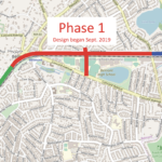
The path is being designed and constructed in two phases. Phase 1 includes the rail trail from Brighton Street through Belmont Center to the Clark Street pedestrian bridge and also the railroad underpass from Alexander Avenue that extends along the future Belmont Middle and High School to Concord Avenue. Phase 2 continues from the Clark Street pedestrian bridge to the Belmont/Waltham line.
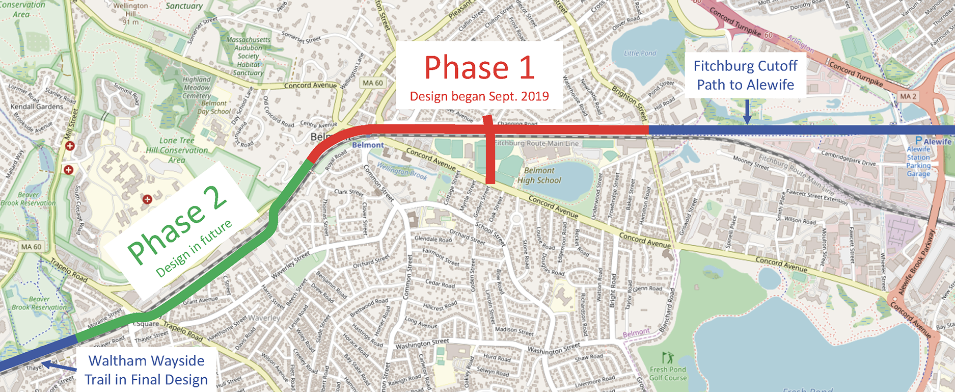
Design and construction phases of the Belmont Community Path. Source: Friends of the Belmont Community Path
Phase 1 has two components. Phase 1a includes a railroad underpass between Alexander Avenue and the Belmont Middle and High School and an extended path across the campus to Concord Avenue. Phase 1b is the portion of the path from the Clark Street bridge to Brighton Street, where it meets the existing Fitchburg Cutoff Path to Alewife Station.
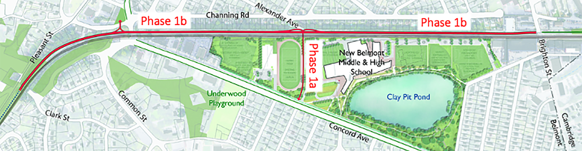
Design and construction phases 1A and 1B of the Belmont Community Path. Source: Friends of the Belmont Community Path
Will the path be safe?
Yes, the path will be safe. The path will be completely separated from the MBTA railroad corridor by a continuous fence.
To accommodate different types of users, in most locations the paved path will be 12 feet wide with a 4-foot shoulder. In certain locations, such as Belmont Center and the Alexander Avenue underpass, the path will narrow to 10 feet due to site constraints.
The path will also include new signals and gates to enhance safety at the Brighton Street crossing. The underpass tunnel will include lighting to improve safety.
How are concerns about the path being addressed?
The town hired Nitsch Engineering to design Phase 1. Nitsch has met with stakeholders to solicit feedback to inform the project design.
Stakeholders have expressed concerns about privacy, security, noise, drainage, and parking. To address these concerns, Nitsch’s proposed design includes:
- extensive vegetation and screening for abutters,
- a network of swales and sub-drains to reduce water runoff and improve drainage, and
- parking restrictions near the Alexander Avenue underpass access point.
- As the project moves forward, Nitsch will continue to seek input from stakeholders to enhance the project’s design.
Who is paying for the path?
Payment for the path is divided into design and construction phases. Funding for the design of Phase 1 has been allocated from the town’s Community Preservation Act funds and from MassTrails, a state interagency initiative led by the Governor’s Office.
Construction costs are expected to be covered by the federally funded Transportation Improvement Program (TIP), a five-year budget plan administered by the Boston Metropolitan Planning Organization (MPO).
While construction of Phase 1 is listed in the TIP “Universe of Projects,” it has not yet been programmed. In 2021, the MPO will assign a specific fiscal year for funding based on factors such as safety, mobility, sustainability, equity, and economic vitality relative to competing projects from other towns. Construction of Phase 1 will only start once TIP funding is in place, and will take at least another year to complete after it is funded.
How can I learn more and give input?
If you are interested in learning more or getting involved, please contact the Friends of the Belmont Community Path at belmontpath@gmail.com. Opportunities to explore the work that has been done to date and track future opportunities for giving input include:
The Community Path Planning Committee
Belmont Community Path Feasibility study
A webinar on the MassTrails team, the path, and the TIP funding process
A complete history of the project
How will the Belmont Community Path link to other local paths?
Construction of neighboring links on the Mass Central Rail Trail continues to move forward:
- The Fitchburg Cutoff segment from Alewife Station to Brighton Street was completed in 2013.
- The Wayside Trail segment from Weston to Wayland was completed in 2019.
- The Somerville Community Path segment adjacent to the Green Line Extension is expected to be completed by the end of 2021.
- Waltham has completed a final design for the segment of the path directly to the west of Belmont. That segment is budgeted for construction in the next fiscal year.
The Belmont Community Path is a critical link. Clear plans and support from town leaders and residents this next year could yield outside funding to build a major town amenity, and broad support could accelerate the timing. In addition, Belmont should begin the design process for Phase 2 as soon as possible to avoid significant delays in the funding and construction of Phase 2.
Sara Smith, Eric Batcho, and Jarrod Goentzel are members of Friends of the Belmont Community Path. They can be reached at belmontpath@gmail.com.

Sorry, the comment form is closed at this time.