By Vincent Stanton, Jr.
The Belmont Community Path is approaching an important milestone—a potential construction funding decision by the Boston region Metropolitan Planning Organization (MPO). Although municipalities, including Belmont, are responsible for funding path design and for securing the path right of way, state and federal governments fully fund path construction via the Transportation Improvement Program (TIP). Construction costs are generally about 85% of total project costs. TIP funds are allocated to cities and towns in the greater Boston area via a competitive process administered by the Boston MPO, which receives about 80% of its budget from the federal highway and transit administrations and about 20% from the Massachusetts Department of Transportation (MassDOT).
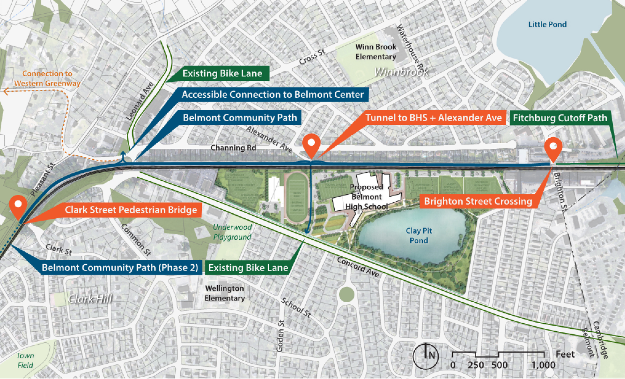
The Boston MPO operates on a five-year budget cycle. The TIP budget for fiscal years 2023–2027 is currently being debated. At a March 31, 2022, meeting the MPO agreed on a draft TIP budget for fiscal years 2023–2027 that includes $21,034,382 in FY 2026 for construction of phase 1 of the Belmont Community Path (Brighton Street to the Clark Street bridge, plus a tunnel beneath the Fitchburg Line at Alexander Avenue and a path spur across the new middle-high school campus to Concord Avenue). Assuming the final TIP project lineup retains the Belmont path, which seems likely (the MPO will make its final decision in May), this is a big deal for Belmont!
Map of the proposed Phase 1 Belmont Community Path design. Graphic by Nitsch Engineering.
An obvious question: why, at $21 million for about 1.31 miles, is the Belmont path so expensive to build? This article will attempt to address that question, in part by comparing the Belmont project to Waltham’s segment of the Massachusetts Central Rail Trail (MCRT).
Belmont vs. Waltham costs
However, first note that the $21 million number is the projected 2026 cost; it reflects an inflation adjustment of roughly 6% per year. The cost in October 2021 dollars, as estimated by Belmont’s design consultant Nitsch Engineering, is $16,698,309.
For comparison, the budget for the Waltham segment of the MCRT, which covers 2.74 miles, also in 2021 dollars, is $9.3 million. In March 2022 the Waltham City Council approved Mayor Jeanette McCarthy’s request for $9.3 million in borrowing authority to construct the Waltham path. The appropriation was based on five construction bids received in January, ranging from $8,965,851 to $11,597,336.
The Belmont segment will cost $12.7 million per mile, while the Waltham segment will cost $3.4 million per mile.
The tunnel
The Belmont path includes a new tunnel under the tracks, estimated to cost $6 million. There is nothing comparable in Waltham. Though two timber bridges will be removed and replaced with steel and concrete, the use of existing abutments makes that a relatively low cost endeavor—only $130,000 in the low bid. The MBTA insisted that the Belmont tunnel be constructed by jacking rather than the more economical cut-and-cover method, due to concerns about soil compaction. Subtracting $6 from $16.7 lowers the cost of the Belmont path to $10.7M, or $8.2 million/mile.
MBTA issues
Most of the Belmont path is located on MBTA property, in some cases within 13 feet of the Fitchburg Line tracks. Thus every aspect of the project will require close collaboration with the MBTA, which has a reputation for bureaucracy and inefficiency, notwithstanding support for the path from top management.
As an example, securing permits to drill for soil samples on MBTA land at Alexander Avenue (necessary for design of the tunnel) took more than a year, apparently because of miscommunication between Keolis, the company that operates the commuter rail system under contract to the MBTA, and the MBTA property office, and perhaps partly due to the pandemic. In consideration of the expected complexity of working hand in glove with the MBTA, the Belmont path budget includes not only a customary 10% contingency for unanticipated events, but an additional 10% contingency added by MassDOT, plus an additional 5% to reflect the cost of close cooperation with the MBTA. These contingency funds amount to $1,309,671 + $1,309,671 + $654,836, for a total of $3,274,178. Thus the pre-contingency cost of the Belmont path is estimated to be $13,096,713.
If the cost of the tunnel is subtracted, then the path cost drops to $7,096,713, or $5.4 million per mile. In contrast, the Waltham path budget, which does not explicitly break out contingency costs, appears to include a contingency of only 3.7%, based on the difference between the lowest base bid and the $9.3 million appropriated.
Street crossings
The Waltham path can be easily reached at street crossings (the path intersects 10 streets), so little construction is needed for path access, while the Belmont path, which doesn’t cross any streets between its Brighton Street and Clark Street termini, requires construction of extensive ramps to facilitate access from adjacent roads. In particular, a rotary will be constructed at the Alexander Avenue side of the tunnel, connecting the east-west main path to the north-south tunnel with spurs to Channing Road and Concord Avenue, and to a service road parallel to the tracks for MBTA vehicles.
There will also be connections from the path to both sides of Belmont Center. Specifically, there will be a ramp along the east side of the Chase Bank lot at 7 Channing to facilitate direct access to businesses on the east side of Leonard Street (where most of the shops and restaurants are located), as well as a new ramp next to the existing stairs at Belmont Center Station. All three of those locations, as well as the path segment leading up to the Clark Street Bridge, will require construction of substantial retaining walls due to steep terrain, another costly item mostly absent from the Waltham path budget.
Drainage
The Belmont path east of Belmont Center includes a drainage system comprising a swale (a gravel ditch to collect water) drained by an eight-inch pipe that will carry the water to Clay Pit Pond or Little Pond. More than 5,000 feet of subterranean pipe will be laid to complete this system, costing $416,000 in pipe alone. The Waltham path, which does not traverse as many low-lying, flood-prone areas, includes much less extensive drainage infrastructure—just three small trailside drainage ponds, budgeted at a total cost of $150,000.
Staging area limits
The Waltham path will be built along an abandoned railroad right of way, much of it surrounded by woods, with comparatively few residential abutters. Consequently, access for construction equipment and staging areas to lay out materials are generally unconstrained in Waltham. In contrast the Belmont path will be built mostly on MBTA property, with abutter backyards on the opposite side. The very limited access to the work site (as noted above, there are no crossing streets) will increase the cost of ferrying workers, materials and equipment to the work site.
Live railroad lines
The MBTA requires railroad flaggers for any work along live railroad lines. There are currently 34 Fitchburg Line trains per day, plus occasional freight trains. The Belmont budget includes $327,418 for police details vs. $65,000 in the Waltham budget.
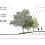
Nitsch Engineering illustration of Channing Road landscaping from the Community Path Project Committee’s November 2021 presentation on the Community Path’s 25% design phase.
Backyard fences
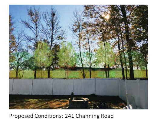
Proposed path landscaping as seen from a Channing Road back yard. Graphic: Nitsch Engineering
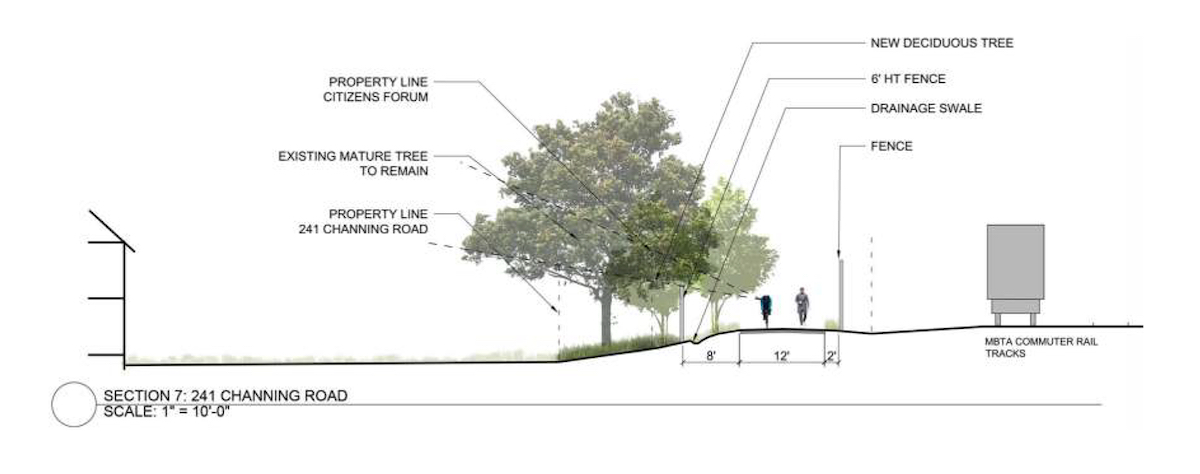
Because the Belmont path passes by 51 Channing Road backyards and three Pleasant Street backyards, virtually the entire corridor will be landscaped, and because the path runs along a train line an insurmountable eight-foot-tall, tight-mesh chain link fence will separate the tracks from the path, at a cost of $346,000 for fencing materials. In contrast, much of the Waltham path passes through wooded areas that do not require elaborate landscaping, and no barrier against a live train line is needed.
Waltham and Belmont have similar costs
The available budgets for the Belmont and Waltham projects do not break out costs into exactly the same categories, and the line items in the budgets are challenging to translate into the categories described in the latter five categories above. However, it seems likely that these five factors account for at least another $2 million in higher costs for the Belmont path, mostly attributable to retaining walls, as suggested by the $765,000 budget for concrete and the $272,000 budget for structural steel in the Belmont budget. Those costs are not matched by corresponding line items in the Waltham budget.
If that calculation is approximately correct, then adjusting the cost of the Belmont path for an additional $2 million of special items would bring its apples-to-apples cost vis-a-vis the Waltham path to about $3.8 million per mile vs. $3.4 million, which is a lot easier to understand.
Vincent Stanton, Jr., is a director of the Belmont Citizens Forum. He also serves on the Belmont Community Path Project Committee. The views expressed in this article are entirely his own.

Sorry, the comment form is closed at this time.