
By Meg Muckenhoupt
The e-mail that went out on Friday, March 6, was short and to the point: “Please be aware that today a building permit was issued for foundation work at the Belmont Uplands site,” wrote Glenn Clancy, Belmont’s Director of Community Development. “AP Cambridge Partners has fulfilled all requirements under the Zoning Board of Appeals Comprehensive Permit and the Massachusetts State Building Code necessary to secure a building permit.”
The permit ends a decade-long struggle over the fate of the Uplands, a 13-acre site that straddles Belmont and Cambridge at the edge of the Alewife reservation. Now, the way has been cleared for Prudential Financial to build “The Residences at Acorn Park,” a complex of 298 apartments off Acorn Park Road.
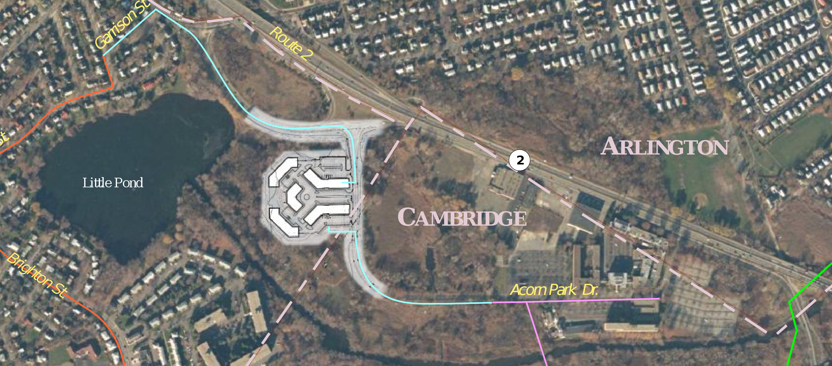
Aerial view of planned Uplands development
Opponents have objected to the project primarily because of its potential to increase local flooding. The project will add 300,000 square feet of impermeable surface in a locale which already suffers considerable flooding during 100-year storms, or storms which are severe enough that they have just a 1% chance of happening in a given year. Although the developer has provided flood storage for stormwater, as required by stormwater regulations, opponents state that it won’t accommodate the water from coming storms.
Storms Will Challenge Structures
At present, stormwater standards specify a 100-year storm in Belmont as a brings 6.5 inches of rain in 24 hours or 8.5 inches in 48 hours. That number derives from research published in 1961.Unfortunately, thanks to increased development in the watershed and the increasing frequency of severe storms due by climate change, Belmont has suffered several 100-year storms in the past 20 years: in October, 1996, June, 1998, and March, 2010. Updated research by a joint project of the Northeast Regional Climate Center (NRCC) and the Natural Resources Conservation Service (NRCS) (precip.eas.cornell.edu) indicates that the rainfall estimate for 100-year storms is much too low for the Boston area, and should be 8.6 inches in 24 hours (see “Is Belmont Ignoring 50 Years of Rain Data?” Belmont Citizens Forum Newsletter, May 2014).
“…I would ask who will be responsible for damage in the future because the town let the Developer build insufficient capacity even though the town had received new information about rainfall?”
However, it’s not so easy to change regulations to reflect new data. According to Kathleen Baskin, director of water policy at Massachusetts Executive Office of Energy and Environmental Affairs, the Department of Environmental Protection is currently evaluating a new draft US National Oceanographic and Atmospheric Precipitation Frequency Atlas 14, Volume 10 (New England). However, the actual Atlas 14 isn’t due to be published until this fall—and even then, it would take time to change the regulations to reflect the new precipitation totals. The DEP’s regulations specify NOAA Technical Paper 40 as the basis for rainfall estimates, and to change those regulations means creating new rules, giving the public time to comment, and revising the rules in light of those comments—“a 6-9 month rule-making process,” Baskin wrote.
Other recent and upcoming studies also make the case that the Residences at Acorn Park are being built in the wrong place at the wrong time. On March 17, the city of Cambridge will present the interim results of Cambridge Climate Change Vulnerability Assessment, which will identify which areas of the city are expected to suffer increased flooding in coming years (see box.) One of those areas is likely to be the land surrounding Alewife Station and Acorn Park Drive. That area was singled out last fall in the Urban Land Institute’s report The Urban Implications of Living With Water (see “Report Details Strategies for Alewife Floods,” Belmont Citizens Forum Newsletter, November 2014).
The amount of stormwater entering the Little River will also increase from another development: the constructed wetlands on the Alewife reservation. Built as part of a plan to separate Cambridge’s stormwater and sanitary sewers, this wetland is designed to send stormwater from nearby Cambridge neighborhoods to the Little River instead of Deer Island. The Environmental Protection Agency set a deadline of December 2015 for completing this project. The effects of this new stormwater plan should become visible in spring 2016.
Putting more pavement next to a vulnerable floodplain increases the risk of flooding; the billion dollar question is whether the flood storage planned at the Residences at Acorn Park will be enough. Despite years of legal challenges and activism, the Uplands stormwater system has been deemed sufficient, despite strong evidence that it will fail in a future storm. In a joint e-mail to Glenn Clancy, Anne-Marie Lambert and Fred Paulsen inquired, “…I would ask who will be responsible for damage in the future because the town let the developer build insufficient capacity even though the town had received new information about rainfall?”
The Residences at Acorn Park will feature more than 462 parking spaces, contributing traffic to the already clogged Route 2 during morning and evening rush hours.
Activists have also deplored the development’s devastating effect on local wildlife. Until the Upland’s owners decimated the site’s trees last fall, it was one of the few sheltered areas near the Alewife Reservation that was not subject to seasonal flooding, providing breeding grounds for species ranging from white-tailed deer to ovenbirds. Time will tell how much local biodiversity will be lost due to this habitat loss.
Meg Muckenhoupt is editor of the Belmont Citizens Forum Newsletter

White-tailed deer photographed near the uplands site. Photo by Andrew Joslin

Sorry, the comment form is closed at this time.