Maps
Alewife Reservation/ Belmont Uplands Maps
Western Greenway
Lone Tree Hill
Walking in Belmont
Waverley Trail
Bicycling
FEMA Flood Maps
Belmont Waterbody Assessment Map
Alewife Reservation Parking and Uplands Trails
View a Google Map of Alewife Reservation Parking here, courtesy of the Coalition to Preserve the Belmont Uplands.
Map of Uplands Trails and the Acorn Park Drive parking lot by the Coalition to Preserve the Belmont Uplands.

Western Greenway
Map of the Western Greenway by Penn Edmonds

Schematic map of the Western Greenway (Waltham Land Trust)
Lone Tree Hill
A larger map of Lone Tree Hill.

Walking in Belmont
Walk Boston’s Belmont walking routes map
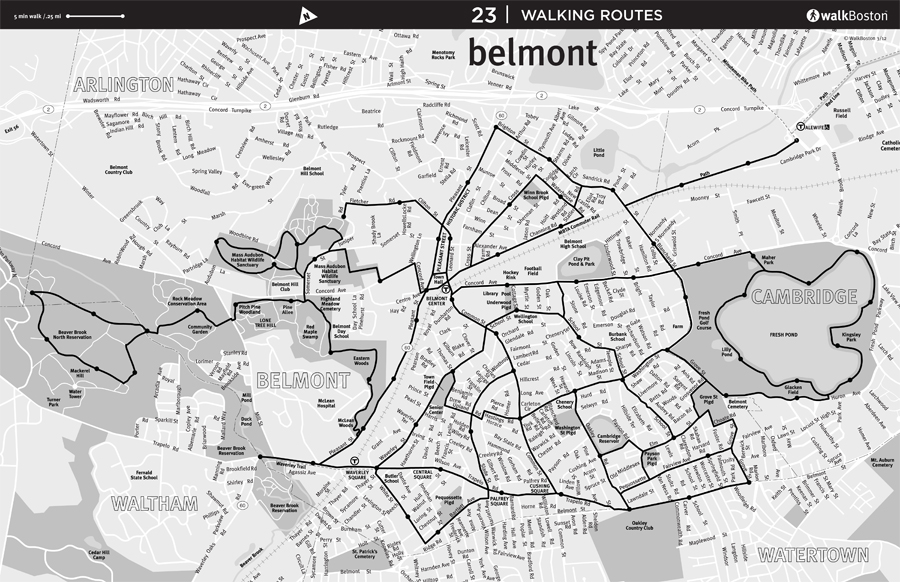
Click on map to see full size image at WalkBoston.org
Waverley Trail

Bicycling
Proposed Belmont/Waltham Trail Alignment Map

Click to see larger map at MAPC.org
FEMA Flood Maps
You can find the Federal Emergency Management Agency’s Flood Insurance Rate Maps (FIRM) of Special Flood Hazard areas on the FEMA web site. The maps can be viewed on-line or purchased on CD for $4.