Athletic Fields? Police Station? Solar Farm? Bike Park?
by Lucia Wille
Belmont’s former trash incinerator facility occupies 25 acres on Concord Avenue, close to the Lexington town line. About two-thirds of the site was owned by the Commonwealth of Massachusetts until May 2017, when it was conveyed to Belmont. The conveyance represents a windfall for a town often struggling with space constraints. As Belmont balances its municipal and recreational needs, the incinerator site presents a valuable opportunity for the community to either ease municipal space constraints or add to its portfolio of recreational assets, with the potential to further Belmont’s status as a desirable town for current and future residents.
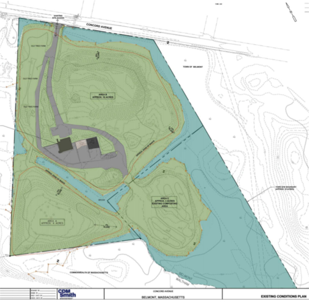
The incinerator site borders Concord Avenue to the north. Parcel C is at the top, while Parcels A and B are at bottom left and right, respectively, with the former incinerator in the in the central gray area.
The incinerator site is surrounded by the Rock Meadow conservation land to the south and east and by the Beaver Brook North Reservation to the west. Both Rock Meadow and Beaver Brook contain heavily traversed multiuse trails, including the Western Greenway, a destination for families, hikers, dog walkers, and mountain bike riders.
The town operated the incinerator from 1959 through the mid-1970s. After the incinerator was closed, the site functioned as a transfer station through the mid-1990s.
Because the site also served as a landfill for the incinerator ash, the Massachusetts Department of Environmental Protection (MassDEP) required that it be capped, meaning that a barrier had to be constructed over the landfill surface to protect humans and the environment from the harmful contents. Although Belmont did not own the land, the town was responsible for capping the site. This prompted members of town government to approach our state legislators for help in conveying the parcel to Belmont from the Commonwealth. House Bill 2869 in 2014 accomplished that result.
The bill restricts future use of the land to noncommercial applications, such as “recreation, public works, and other municipal uses.”
Physical Properties of the Site
The site consists of three parcels, referred to as A, B, and C in public town documents (see map on page 1). Parcels A and B represent the approximately 16 acres of land conveyed to the town by House Bill 2869; Parcel C represents approximately nine acres of land the town already owned. Roughly eight acres of the site are wetland resources, meaning that they are protected and cannot be developed. Thus, 17 acres of land are available for potential active use.
Parcel C is currently being used by the Belmont Department of Public Works (DPW)for leaf and yard waste composting. Of this parcel, six acres are wetlands and the remaining approximately three acres could be developed. The land is zoned as Single Residence D, which allows for municipal development and single family residences with a minimum of 125 feet of road frontage, in addition to many other requirements. Parcel C does not abut Concord Avenue and therefore does not have the road frontage necessary for single-family residences. A private developer would be required to apply to the Zoning Board of Appeals for a variance. The land, which is across the street from Belmont Country Club and has easy access to Route 2 and Route 128, might be attractive to a developer.
Parcel B, the site of the incinerator building, abuts Concord Avenue and has approximately 10 acres of developable land. As part of the capping process, the incinerator building will be demolished. The land on Parcel B is currently being used for temporary DPW storage.
Parcel A has approximately four acres of developable land that is currently not being used. To date, all proposals for this parcel suggest reserving it for future use by the DPW as temporary storage. This is necessary to accommodate the DPW’s needs if it were to relinquish use of Parcel C.
The town hired consultants in 2012 to study possible post-closure uses. In 2014, after House Bill 2869 was passed, a community meeting was held to discuss potential uses. A report of that meeting to the selectmen lists four potential ideas: a new police station, the DPW building, recreational ball fields, and/or a solar farm. At the 2016 Town Meeting, Town Meeting members voted to accept parcel A and B from the state; the deed for the land was officially recorded on May 17, 2017.
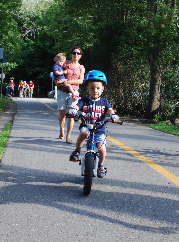
Jack Ubbells of Arlington rides ahead of his mother, Estelle Clamon, and sister on the Arlington section of the Minute Man Bike Trail. Clamon says they would love to see a new bike park.
Post-Closure Usage Assumptions
In both 2012 and 2016, the town retained consultants CDM Smith to evaluate post-closure uses of the site. Only Parcel B was evaluated for future use, as it was assumed that the DPW would need Parcel A for storage purposes. Parcel C was not considered given it could potentially be developed. Parcel B is the only parcel with frontage on Concord Avenue, and any development on areas A and C will have to include an access road through Parcel B. All options outlined below include such an access road.
Belmont Police Station
Of the capital projects identified in 2000 by the town’s Major Capital Projects Working Group as being in need of renovation or replacement, four major projects remain unaddressed: a new or renovated high school, a new police station, a new library, and new DPW facilities. Current thinking is that the high school and library would remain on their current sites.
CDM Smith’s assessment is that the incinerator site could easily accommodate the police station building and required parking. This would include an access road for Parcel C without the need for extensive retaining walls around the building plateau, and additionally, leave enough space available for DPW use. This option would free up the current police station site at Pleasant Street and Concord Avenue for other uses.
One downside of relocating the police station to the incinerator site on the edge of town is possible longer response times. In addition, landfilled ash can compress over time by as much as 20%, requiring supplemental foundation support, adding to construction costs.
The Town DPW
Moving the DPW to the former incinerator site has been considered. However, the CDM Smith report notes that even if a 6 to 8-foot retaining wall was constructed around much (if not all) of the facility plateau in order to maximize the available building space, the land available at the incinerator site is too small to accommodate all of the DPW’s space requirements, which include equipment and sand and salt storage. Building a retaining wall would also significantly increase the costs of constructing a new DPW facility and was not recommended by CDM Smith.
Athletic Fields
Belmont has a shortage of athletic fields for both recreational leagues and school use. CDM Smith’s post-closure evaluation included configurations of either soccer fields and/or baseball/softball diamonds separately or combined. Depending on the configuration of fields, approximately 60 to 70 parking spaces could be added to the field plateau or at the bottom of the hill. CDM Smith’s report recommends further design work to optimize the location of the access road and the DPW’s ongoing requirements for the site. A retaining wall around a portion of the fields may also be required to reach the necessary plateau area.
Ball fields must be relatively flat, with slopes below the minimum required by MassDEP, necessitating either a variance from the state or additional fill to level the surface.
A consideration for developing athletic fields at the incinerator site is a MassDEP regulation that stipulates a maximum and a minimum slope of 20% and 5%, respectively, on capped landfills. Ball fields must be relatively flat, with slopes below the minimum required by MassDEP, necessitating either a variance from the state or additional fill to level the surface, which increases the costs of the final project. Generally speaking, however, ball fields are considered a compatible post-closure use with landfilled sites.
In addition to the known shortage of athletic fields at the high school, there is some uncertainty surrounding the physical dimensions of a new Belmont High School, a project still in preliminary stages.
A significant change of the current footprint may necessitate moving one or more ball fields to a different location. Placing ball fields at a distance from the high school would require busing students on a regular basis from the school to the fields, adding long-term costs.
A Solar Array
Massachusetts has a green initiative to produce 100 megawatts of renewable energy (solar and wind) on former landfills by 2020. If it meets this goal, the state would generate 20% of the electricity used in Massachusetts each year through renewables. This goal supports a larger state-level initiative to reduce emissions by 80% from the 1990 baseline level by 2050.
In addition, Belmont adopted its own Climate Action Plan in 2009, mirroring the state’s goal of reducing emissions by 80% by 2050.
A solar array on the former incinerator site would support Belmont’s and the Commonwealth’s green energy initiatives. According to Becca Keane, an energy resources analyst at Belmont Light (BL), no solid plans have been developed for such an array. However, she indicated that BL would be enthusiastic about considering this option should the town decide to use the incinerator site for this purpose. BL is already researching the feasibility of a utility-scale solar array for Belmont.
There are multiple ways in which a solar array could be installed by BL on the former landfill site. One option is that the array could be owned and operated by the municipal utility.
Another option is that the utility could lease the land, generally for 20 to 25 years, to a third party, which would be responsible for installing and maintaining the array and selling the electricity generated back to the municipal utility. It is too early to determine the impact of a solar array on customers’ utility bills.
A Bike and Skate Park
In addition to the uses highlighted by the CDM Smith report, another potential use of the land would be a bike and skate park. Most people are familiar with skate parks, as there are more than 30,000 public skate parks in the US, including many in the surrounding communities of Lexington, Concord, Cambridge, and Waltham. On the other hand, most people are not as familiar with bike parks.
A bike park is essentially a playground for bicycles. Generally speaking, it’s a set of circular tracks that provide obstacles for the rider as berms and jumps. A well-designed bike park provides a riding space for people of all ages and all skill levels, including the very earliest beginners on balance bikes.
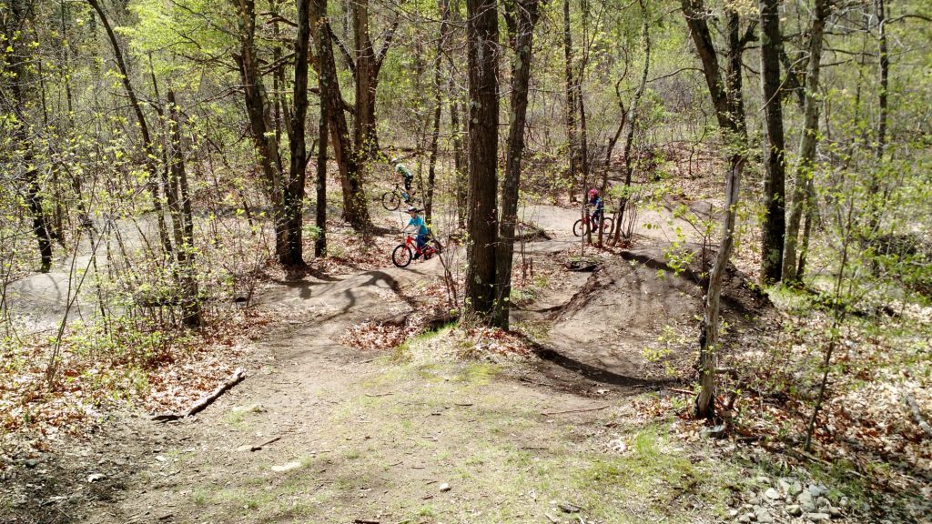
The bike pumping track at Beaver Brook North Reservation in Waltham.
According to Mountain Bike Reviews (MTBR), the US currently has about 1,000 municipal bike parks and pump tracks, and public bike parks are “one of the fastest growing attractions in recreational amenities,” a sentiment echoed by the International Mountain Biking Association. A pump track is a continuous loop of dirt berms and “rollers” (smooth dirt mounds) that you ride without pedaling. The name “pump track” comes from riders shifting the weight of their upper and lower body (rather than pedaling) as they ride around the track. Due to the smooth dirt surface, pump track cyclists of all ages and skill levels can ride, including bikes with training wheels.
The incinerator site is ideally located for a bike and skate park since it is adjacent to an already existing network of extensive mountain biking trails, including the Western Greenway. With the growing popularity of the Western Greenway and the community path getting closer to being a reality, a bike and skate park would further Belmont’s status as a pro-bicycle community.
Next Steps: Town Considerations
The Major Capital Projects Working Group, charged with incorporating the incinerator site into a comprehensive plan that includes all other outstanding capital projects, will be evaluating potential uses. These uses may be temporary, such as storage of building material, or permanent, such as relocating one of the capital projects to the site.
DEP Considerations
The town needs to complete its environmental evaluation of the site, including wetlands and remediation requirements. Once the state approves the evaluation, the town will be required to design a cap, tear down the incinerator building, and finally cap the site. In order to minimize future costs, post-closure use would ideally be determined prior to the capping process.
Lucia Wille is a Belmont resident.
Bike Parks: A Growing Trend
Bike parks are natural-surface cycling terrains containing a combination of pump tracks and slopestyle courses to challenge bikers at every skill level with enough variety to keep riders coming back for years.
Local pump tracks to visit:
• Beaver Brook North in Waltham has a pump track across from the Metfern Cemetery.
• Russell Mill Pond and Town Forest in Chelmsford has a pump track that can be reached by parking at the Mill Road parking lot.
To see photos, videos, and more about bike parks, visit:
• https://bouldercolorado.gov/parks-rec/valmont-bike-park/
• Belmont Bike and Skate Park Facebook page about a potential bike park on the incinerator site to learn of any new developments.

Sorry, the comment form is closed at this time.