Along the north side of Route 2 in East Arlington lie seventeen acres of wetlands almost entirely in the 100-year floodplain. Despite its potential for flooding, this parcel has been the subject of various development proposals over the years.
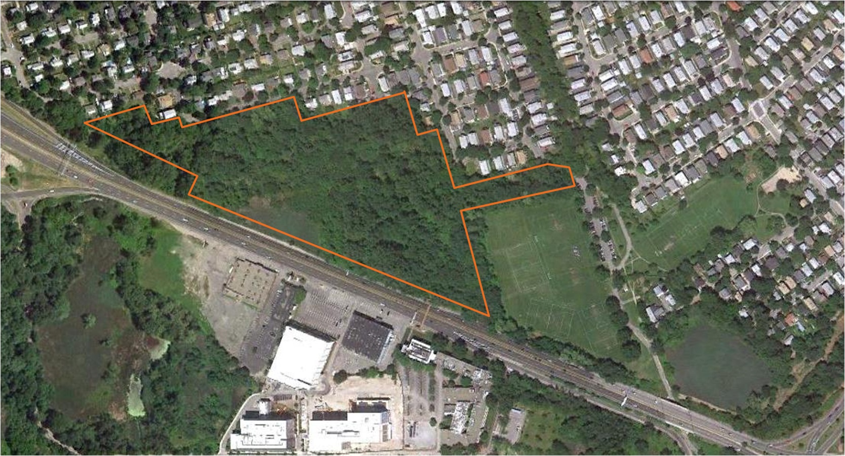
The Mugar parcel, outlined in white, abuts Route 2 (center). This 2011 aerial photo also depicts the former Faces site and parking lot (bottom), now the location of the Vox on 2 apartments. / Arlington Land Trust
Recently Oaktree Development of Cambridge showed Arlington town officials a preliminary sketch of a proposed 219-unit housing development on the parcel owned by the Mugar family and adjacent to the Alewife Reservation.
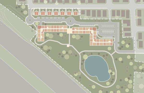
Oaktree Development’s plan for the Mugar site, which it calls “Thorndike Place.”/ Oaktree Development
The Oaktree developer intends to invoke the state Chapter 40B statute to circumvent certain local permitting processes and bylaws by including a certain percentage of affordable housing in the development. No official filings have yet been made.
Arlington town officials have long expressed a desire to protect the parcel through both Arlington’s Open Space and Recreation Plans since 1996 and the newly approved Arlington Master Plan. Repeated efforts by the town and nonprofit organizations to negotiate a conservation outcome with the Mugar family have been rejected. The Arlington Board of Selectmen has instructed the town manager to renew the conservation negotiations.
For more information about the Mugar parcel, and efforts to halt development on the site, contact the Coalition to Save the Mugar Wetlands.
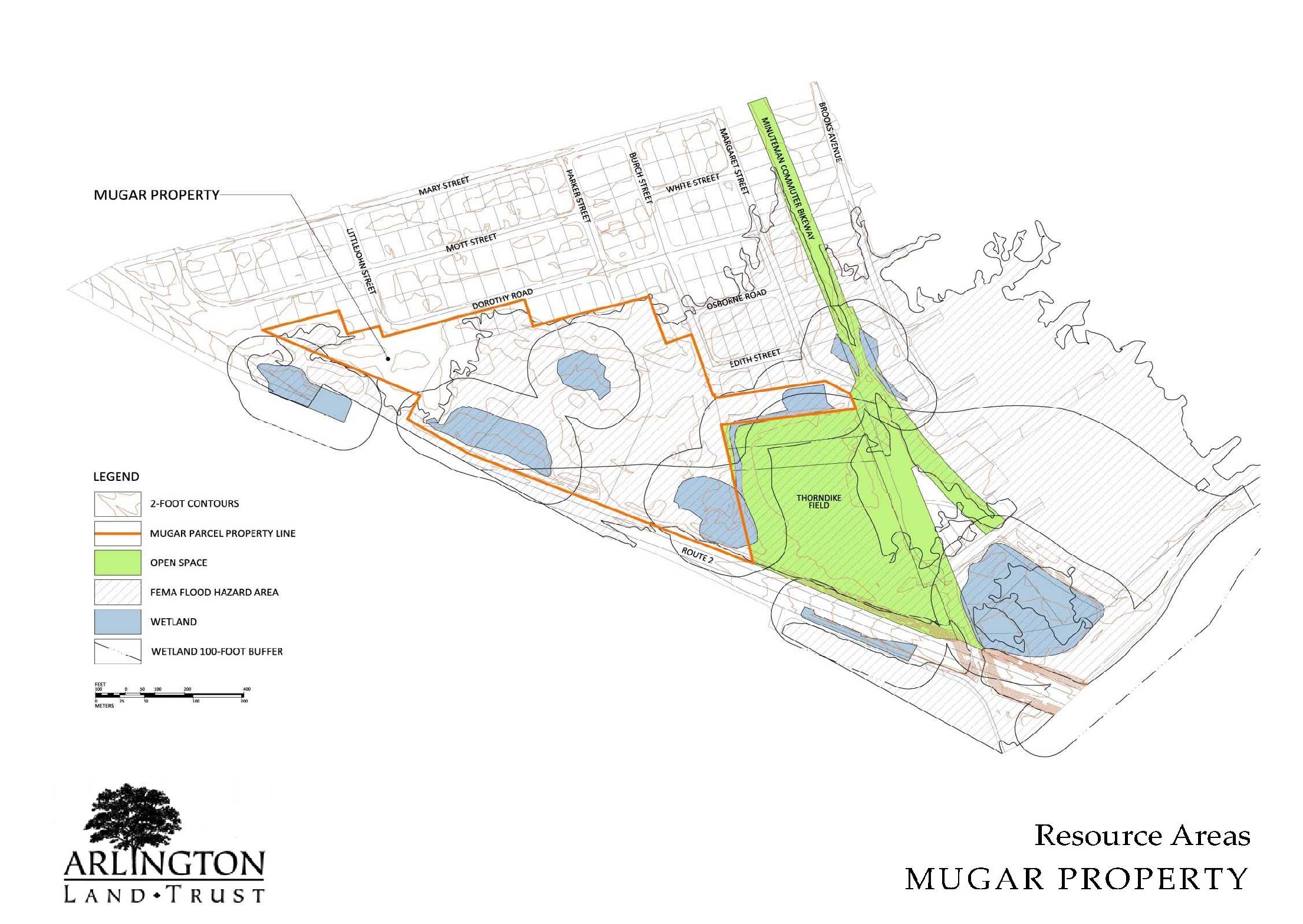
The Resource Plan for the Mugar site, outlined in black, showing the locations of wetlands and the Thorndike recreational field. / Coalition to Save the Mugar Wetlands

Sorry, the comment form is closed at this time.